Geography
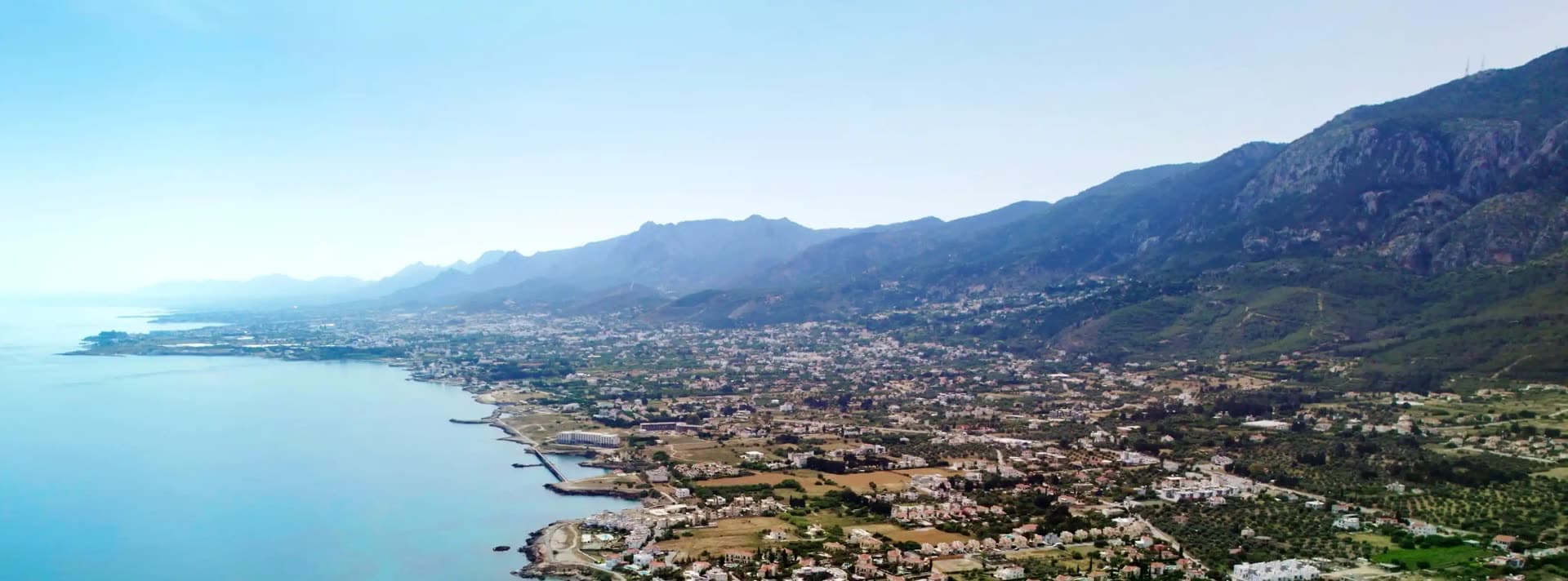
The Kyrenia Mountains run roughly 160 kilometers (about 100 miles) along the northern coastline of Cyprus, forming a long, narrow ridge that rises abruptly from the Mesaoria plain to the south. The range sits close to the Mediterranean shore, giving steep northern slopes that drop quickly toward the coast and gentler inclines on the southern side. Mount Selvili (Kyparissovouno) is the highest peak at 1,024 meters. The proximity of the high ground to the sea made the range strategically important for both settlement and defense throughout history.
Geology
The mountains are made up of sedimentary formations dating from the Permian to the Middle Miocene, pushed up by the collision of the African and Eurasian tectonic plates. Although only about half the height of the Troodos Mountains in the south of Cyprus, the Kyrenia range is notably rugged. The dominant rock is hard crystalline limestone, with bands of marble, which gives the peaks their pale, jagged appearance and supports the karstic features visible across the range.
Climate and Vegetation
The range experiences a typical Mediterranean climate, with hot dry summers and mild wet winters. Rainfall is heaviest on the northern slopes facing the sea. Vegetation includes Mediterranean pine forest, cypress, carob, olive and a variety of shrubs and wildflowers, with endemic species adapted to the limestone terrain. A major fire in 1995 destroyed substantial areas of forest and natural habitat, and reforestation and recovery have been ongoing since.
History
The Kyrenia Mountains are best known historically for their medieval castles. Three major fortresses, St. Hilarion, Buffavento and Kantara, sit astride peaks along the range and were of strategic importance through much of the Middle Ages. They were generally constructed by the Byzantines and later expanded by the Lusignans between the 10th and 15th centuries, controlling key passes between the coast and the interior plain and serving as refuges and watchtowers against raiders and invaders.
Legends and Cultural Significance
The distinctive five-fingered peak gives the range its Greek name Pentadaktylos. One legend describes a villager hurling a handful of mud at a queen, with the imprint of five fingers shaping the mountain. Another tradition credits the Byzantine folk hero Digenis Akritas, whose handprint supposedly marked the peak when he gripped the mountain after emerging from the sea to fight off Saracen invaders. A large painted flag of Northern Cyprus, reported as roughly 425 meters wide and 250 meters high and lit at night, is displayed on the southern slope.
Notable Peaks
Mount Selvili (Kyparissovouno) is the highest summit at 1,024 meters. Other significant peaks include Pentadaktylos (Besparmak) itself, famous for its five-finger silhouette, and the heights crowned by the castles of St. Hilarion, Buffavento and Kantara, each commanding sweeping views over the northern coast and the Mesaoria plain.